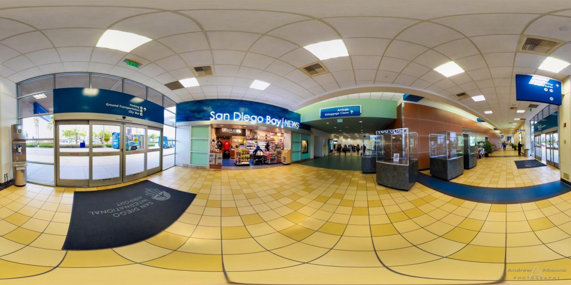
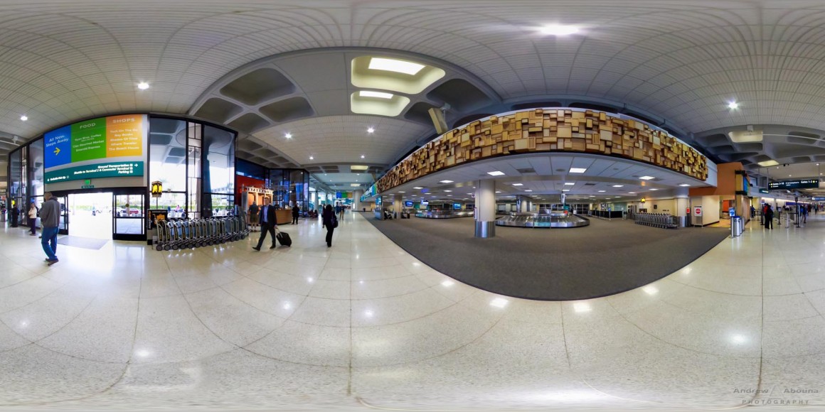
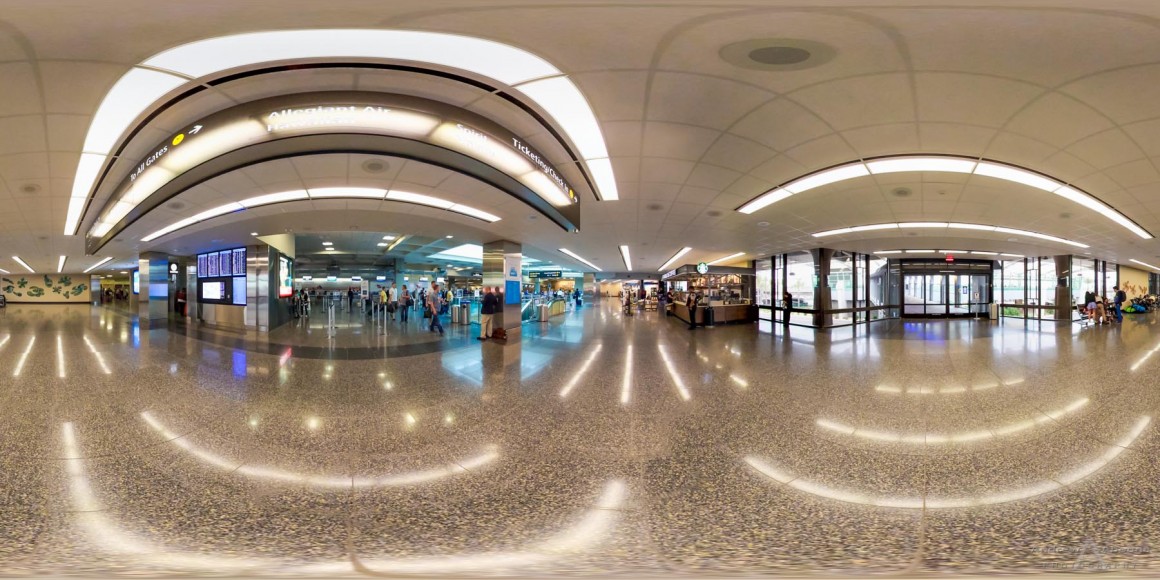
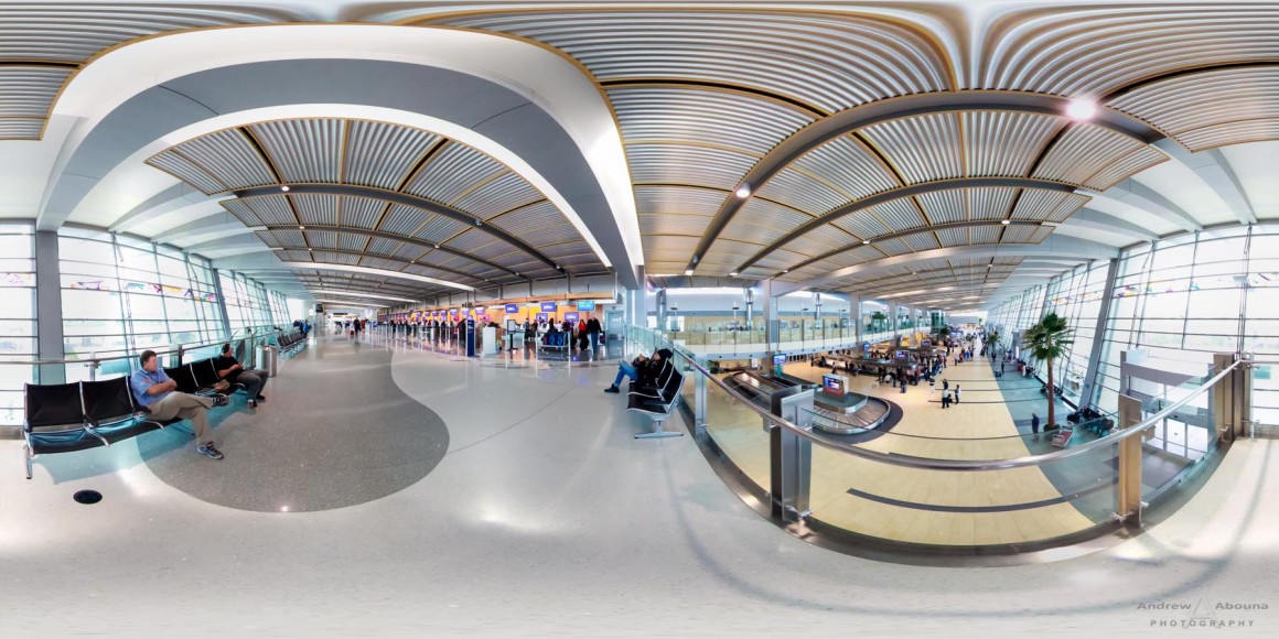
San Diego International Airport 360 View
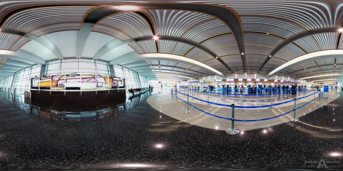
A view like no other. Spherical panoramic virtual photography of the San Diego International Airport (SAN.org). The airport 360 view images, when combined with a panorama view, provide a 360-degree horizontal and 180-degree vertical, interactive view of the airport that you control. Fully corrected for any parallax and edited to ensure the best color and appearance, these new airport 360 view images provide a wonderful virtual view of the San Diego International Airport, allowing visitors to really see where they are, what’s around a given location. It’s the ultimate visual navigation tool for an unparalleled virtual tour.
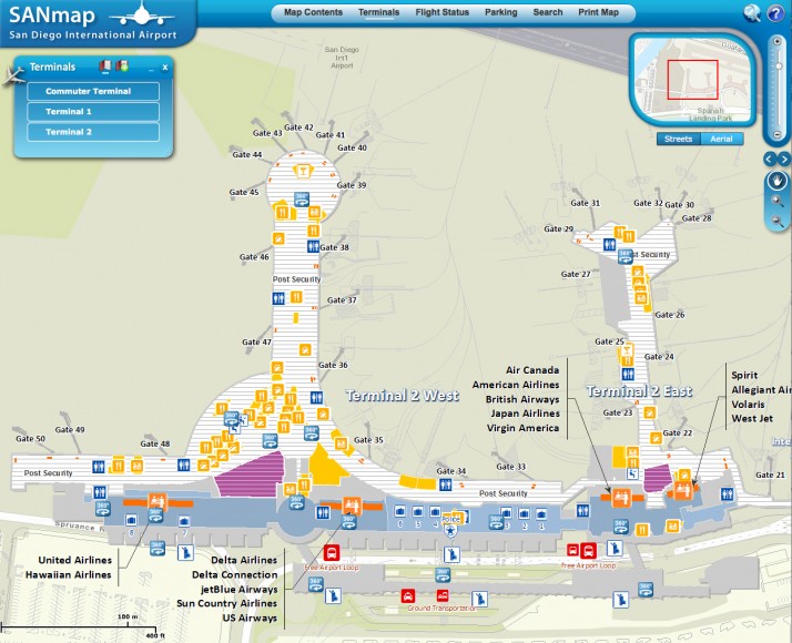
The airport 360 view images are now being used in the airport’s very popular interactive mapping application, SANMap. The mapping application, created by ATKINS North America, will soon be republished to feature the SAN improvements. ATKINS is one of the world’s leading design, engineering and project management consultancies.
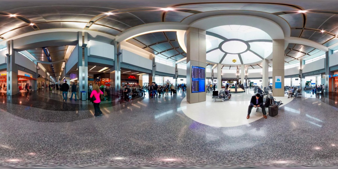
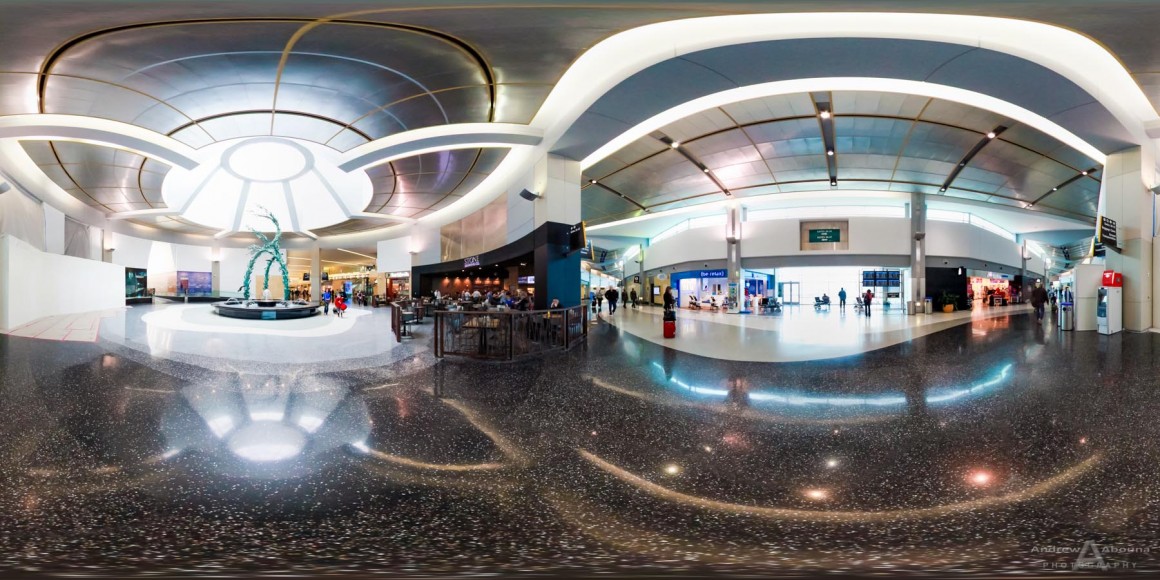
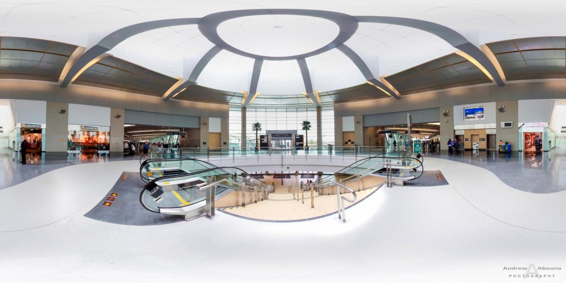
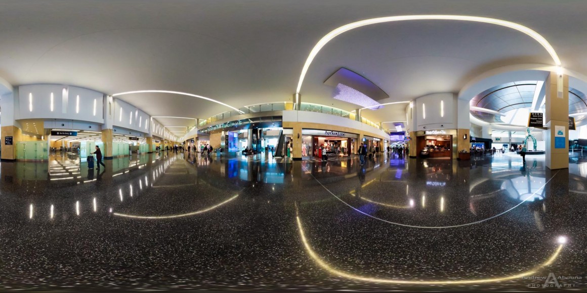
The spherical panoramic photography of these airport 360 view images are being used by the San Diego International Airport Authority to help visitors navigate the airport terminals and services. For the third consecutive year as the airport’s San Diego photographer, we’ve provided complete still shots of airport photography and now again with these spherical panoramas. This update to stills and sphericals provide a very descriptive and elegant view of the airport’s major expansion of Terminal 2. Pan and zoom through the airport 360 view spherical panoramas to see whats’ new at SAN’s Terminal 2, including 10 new gates, transformed shopping and dining, beautiful art, and a second level departures roadway.
More than just functional airport 360 view images, our spherical panoramas are also photographic art because of their unique and visual appeal. What makes the images so wonderful is the way in which they show a location or space. While no camera can possibly replicate the human eye for it’s ability to manage highly contrasting lighting scenes, the eye however cannot see the world in the way that these spherical panoramic photos show.
A larger, complete collection of the 2014 airport photography is also available (password required).
Airport photography from two previous architectural photography shoots that we conducted for the airport also served as a key feature in the airport’s interactive mapping application. The map allows visitors to look at actual airport photos that are both static and dynamic. The dynamic images that Andrew Abouna Photography created were 360-degree spherical, panoramic, virtual photographic views at key airport locations. In addition to being an experienced airport photographer, our virtual views product is an exclusive architectural and commercial photography service, which we have also provided for events, real estate, and adventure photography shoots.
These airport 360 view images are also an example of how spherical panoramas and virtual views can be use in many areas other than airports, such as in architecture, events, construction, transportation, and even weddings, and more. For more information, please contact us.


Like the pics of the airport expansion – I love the travel family sculpture too its so cute!! I would love to see it in person – will have to plan a trip down there soon.