A helicopter aerial photo flight video of our aerial photography assignment to shoot commercial buildings in San Diego and Oceanside, California. With a narration of San Diego sites along the way as well a behind-the-scenes description of actual aerial photos and some procedures of how we capture aerial photography using a low cost helicopter.
We fly from Montgomery Field Airport in San Diego aboard a Robinson R22 helicopter, head north about 35 miles to Oceanside, CA, then fly east, south and west back to Montgomery Field in San Diego. Along the way we make a number of orbits around several project sites to capture aerial photography of buildings a dozen buildings for our client. Great views and an informative flight aboard the two-seat, doors-off helicopter.
Narration of ‘Fly Aboard a Helicopter Aerial Photography San Diego Assignment’ Video
Good morning, and welcome aboard the Robinson R22, two-seat helicopter. This morning we are going on an aerial photo shoot of commercial buildings in the San Diego and Oceanside, California areas. Pilot Will is just going through some final pre-flight checks, and then we’ll soon be underway.
Our flight is going to take us west, then north towards Oceanside, which is about 35 miles north of here, and then we’ll proceed back to San Diego, and we’re ready for lift off now.
The transition to flight, as is the whole flight in the Robinson R22, is very smooth and controllable, and that makes this helicopter very ideally suited to aerial photography.
We’re leaving out of the Montgomery Field Airport area in San Diego. We are going to pass over a couple of freeways, and I’ll point out some features for you along the way. This first freeway that we passed over is State Route 163. These are some nearby commercial and retail buildings.
The next freeway that we are going to pass over is Interstate 805, and you’ll see it now just above the instrument console. It’s morning time, and so there’s still some traffic congestion, as you’ll see on the freeway.
Looking straight ahead is West, and panning left looking south, you might be able to make out part of the downtown San Diego skyline. I’ll pan one more time to the left for you, and you’ll be able to make out part of Mission Bay.
We’re a little more West and North now. The building in your bottom right is the Mormon Church, and the Hyatt you also saw there briefly, the red building. This collection and cluster of white buildings is the University of California San Diego campus.
The interesting terraced building, coming in to the center of the frame now is Geisel Library, named after Dr. Geisel, the creator of the Dr. Seuss series of books. The clarity of the camera – even though I’m using a rather wide angle lens here – but looking out of the helicopter, which has no door, making it ideally suited for aerial photography, you’ll be able to make out a snake on the winding pathway.
This golf course which that’s coming into view, is Torrey Pines Golf Course, which is famous on the PGA circuit. Coming up in a moment you’ll be able to make out the red buildings of the Del Mar Fairgrounds. This is Los Peñasquitos Lagoon. There’s the buildings that I mentioned earlier of the Del Mar Fairgrounds.
That lagoon is Batiquitos Lagoon, so we are coming in to Carlsbad, and we’ll see the Encina Power Station in a moment.
We are now approaching Oceanside, and we’ve arrived the first set of buildings we are going to photograph, near the State Route 76 and Mission Boulevard area. We fly several orbits at different altitudes, giving an opportunity to get different perspectives. Oblique views, as well as shots that are more direct down on the buildings., particularly which you’ll see in the upcoming aerial photos. There’s a total of six buildings that we’re photographing in this area.
We’re looking East now, and having completed the shots we going to head East then South to the other buildings we are going to photograph in the San Diego area.
First we are going to pass over Lake San Marcos, and I’d like to show you Olivenhain Dam which is here in the screen now. It’s one of many reservoirs in the San Diego area.
Next to Olivenhain Dam you’ll see another body of water, and that’s Lake Hodges. The wind that you hear is again because there is now door on the helicopter, and so it’s very easy to pickup wind and the outdoor temperature, which is actually quite warm today, which is about 85 or 90 degrees. And even though we are flying now at about 85 knots, and an altitude of about 1500 feet, it’s very comfortable.
We’ve arrived here at our other buildings in the San Diego area, showing again the different oblique views, different perspectives, that were captured as part of the aerial photography of these commercial properties. Photography was conducted at all points around the building, even shots more directly downward.
Coming up in the next image, you’ll see the ground view of that very same building that we captured from the air.
This is different set of buildings. Again, we are offering the same type of oblique views and different perspectives of aerlal photography., using all professional equipment with the best lenses to ensure the best image quality.
This is a view from the ground of that same set of buildings that we just captured from the air.
We’ve now arrived at our final set of buildings, it’s the linear image pair of buildings in the center of the screen. Again, we did orbits around the buildings, getting a variety of perspectives. Looking again at the front of the building, and then the front of the building from the ground.
On our return flight now back to Montgomery Field, we passed over Marine Corps Air Station Miramar, after having gotten approval from the Miramar Control Tower, we were able to proceed safely over the military airport.
I’ve switched now to a wider lens to give a broader view out the helicopter. You can get a good feel just now just how this helicopter provides the most clearest view without having any doors on the side. And even through the front screen it’s a very clear view.
Passing over some multi-family residential areas, more commercial buildings, and then you can see the runway for Montgomery Field just ahead.
We are flying at about 60 knots now, but slowly reducing our speed, as we begin to make our partial orbit around the Montgomery Field Airport complex.
Down below you can see a helicopter with its rotor spinning, that’s in the general area of where we are going to be landing shortly.
You can see on the high horizon, the far horizon, some of the mountains to the East of San Diego County.
The nice smooth orbit that you see that we are doing here, gives a really good example of exactly how we did the aerial flight that we did over the buildings that we photographed earlier. We in fact use a much tighter orbit over those buildings.
And one of the great advantages of using the helicopter, as I mentioned earlier, is the precise contract of the aircraft, the ability to hover. But, as we demonstrated today, in a very short amount of time we were able to cover many buildings throughout the whole flight, of just one mission. And that mission captured 10 (actually12) buildings in one aerial photography assignment, which otherwise could take several flights.
We’re making our final approach now. We’re going to pass alongside the helicopter who’s rotor we saw spinning earlier. The helicopter just in the center of the screen that you see coming into view now, is Mercy Life Flight.
And there are two helicopters up ahead. The red one is the who’s rotor was spinning earlier. And the one a little bit closer to us is also a Robinson R44, a four-seat helicopter.
The two-seat that we’re in now, the R22, has a lower operating cost, it’s doors are off for us, and it’s just a very, very efficient, relatively low-cost way for capturing aerial photography.
A nice, very smooth landing. So in one and half hours we covered about 80 miles and captured 10 (actually 12) buildings for aerial photography.
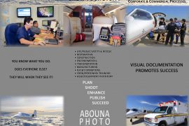
So I invite you to visit my website for more information about this aerial photography mission, and accompanying architecture photography as well. That’s at AbounaPhoto.com.
For more information about aerial photography, please contact us.